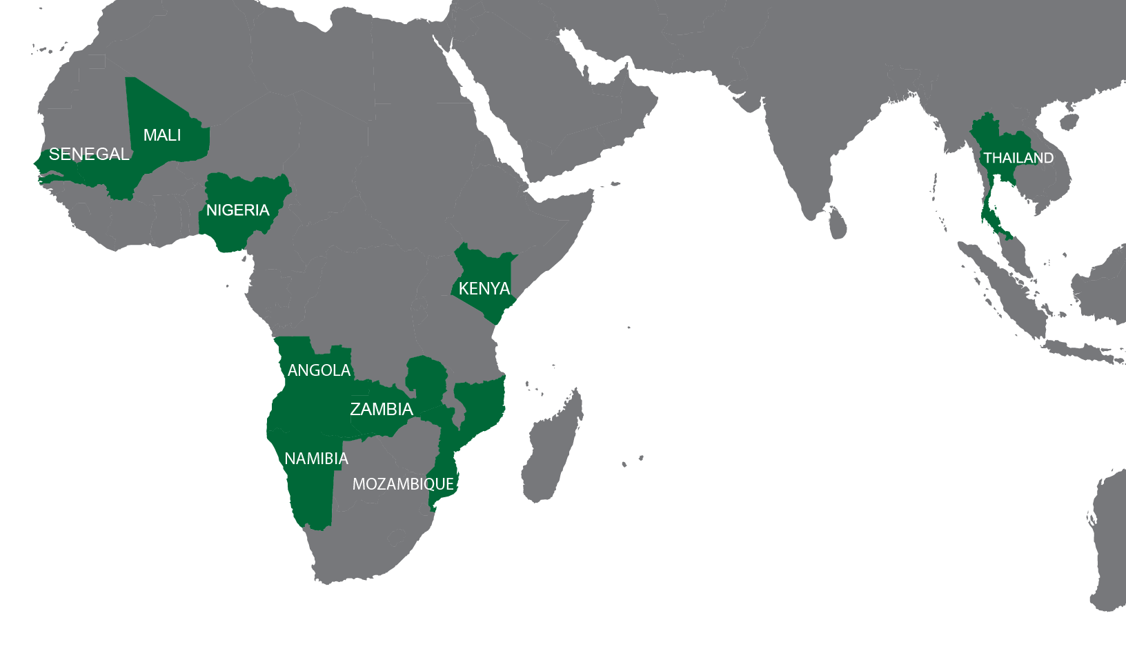
Check out this interactive StoryMap HERE on how Reveal was used for malaria prevention in Thailand via foci investigations.
Failing to deliver important health interventions to all households means leaving families vulnerable to some of the world’s most threatening health concerns—like malaria and measles.
The traditional approach to intervention delivery in low-resource settings relies on field teams to locate homes on the ground, with limited ability to track whether these teams actually reach their targets. Finding homes is challenging in these settings; those in need are often in areas with no address systems and where homes are not mapped. Further, intervention managers rely on field reports to determine whether services have adequately covered all houses in need. The result? Services only reach the houses that are manually found. Studies show that, when delivering interventions without Reveal, field teams often miss a large portion (40%) of the houses they were meant to cover. In short: while reports may indicate high service coverage, the true picture shows huge swathes of the population are actually missed by field teams and excluded from coverage numbers. This challenge represents one of the greatest failures of global public health—and one which we can and must fix.
Reveal ensures equitable access to life-saving immunizations, antibiotics, and protective measures by supporting field teams in identifying where people live and what services are needed. Reveal promotes powerful analytics by combining geospatial data and context-specific planning and accountability tools to provide necessary information that ensures all families in need are found and receive services.
Reveal uses interactive maps that can be tailored to specific country settings. This customized technology can guide and monitor progress of field campaigns. With these maps and the data collection they facilitate, access to data for decision making is more transparent and improves coverage and optimization of resources.
Teams must be able to plan effectively, respond precisely, capture household data, and monitor progress.
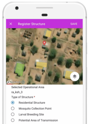
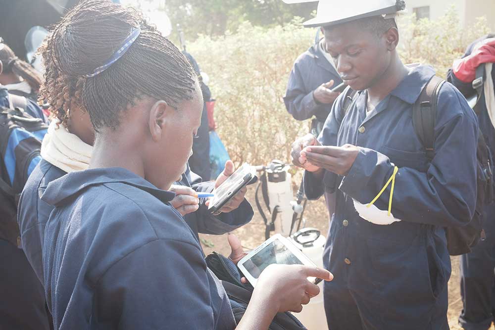
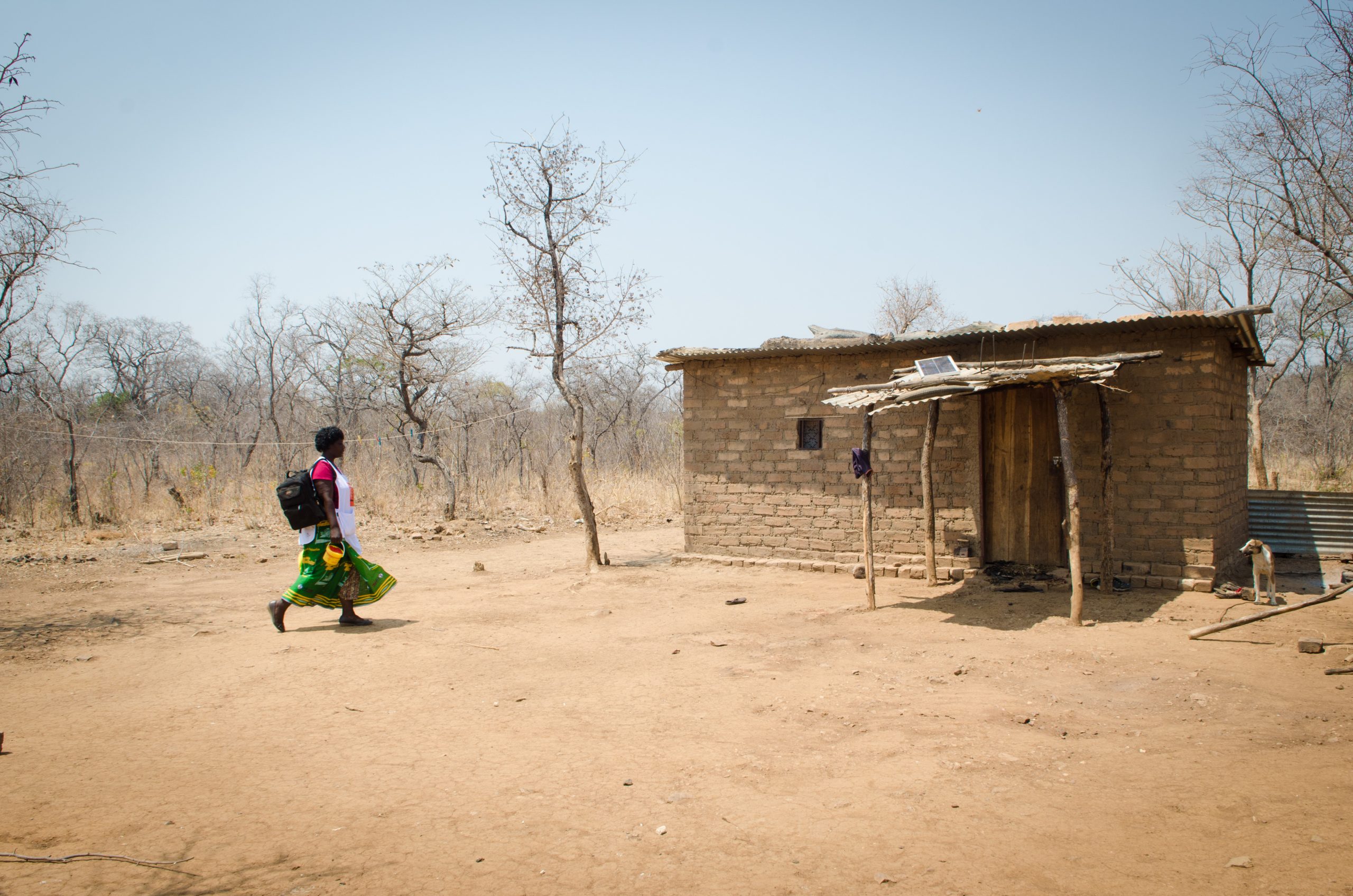
Frontline workers use maps loaded in the application to guide field delivery. Intervention managers use the web-based interface to track and monitor teams, allowing for active performance monitoring and course correction in near real time.
Tams must be able to plan effectively, respond precisely, capture household data, and monitor progress.
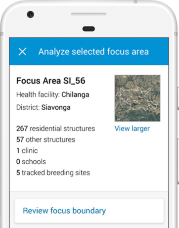
“With the maps, we can target the structures that are eligible for the program. Now when you go to an area, you find that the number of structures indicated on the maps is exactly the number of structures there.”

Jerry Maambo—Malaria Elimination Officer, Eastern Province, Zambia
Plan
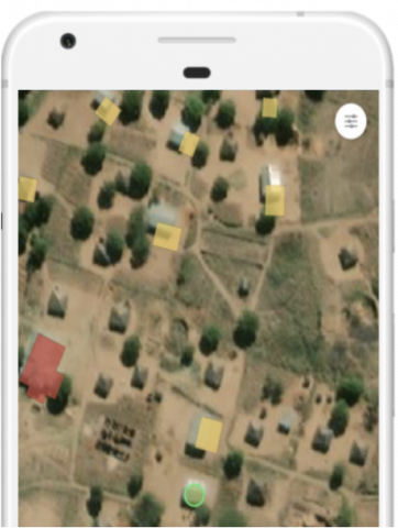
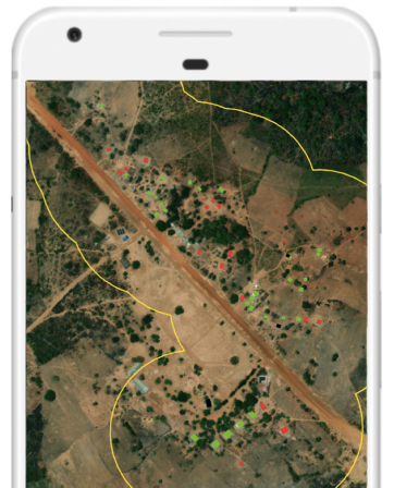
Satellite imagery is enumerated to create maps for targeted intervention planning.
An in-field application uses maps and GPS to guide teams to service delivery areas.
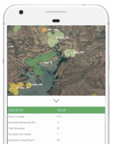
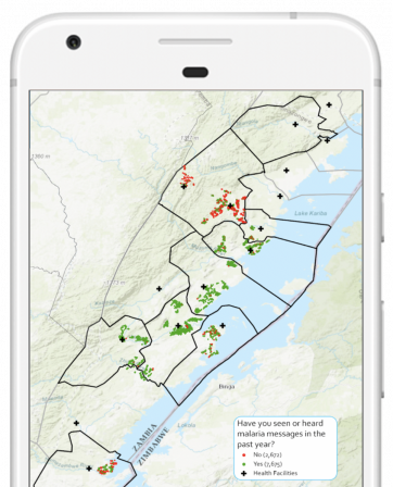
Monitor
Mid- and high-level administrators use tailored dashboards to monitor intervention progress in near real time.
Adjust
Using these dashboards, administrators are able to course correct mid- based on field progress and obtain true coverage rates.
Failing to deliver important health interventions to all households means leaving families vulnerable to some of the world’s most threatening health concerns—like malaria and measles.
Reveal uses interactive maps that can be tailored to specific country settings. This customized technology can guide and monitor progress of field campaigns. With these maps and the data collection they facilitate, access to data for decision making is more transparent and improves coverage and optimization of resources.